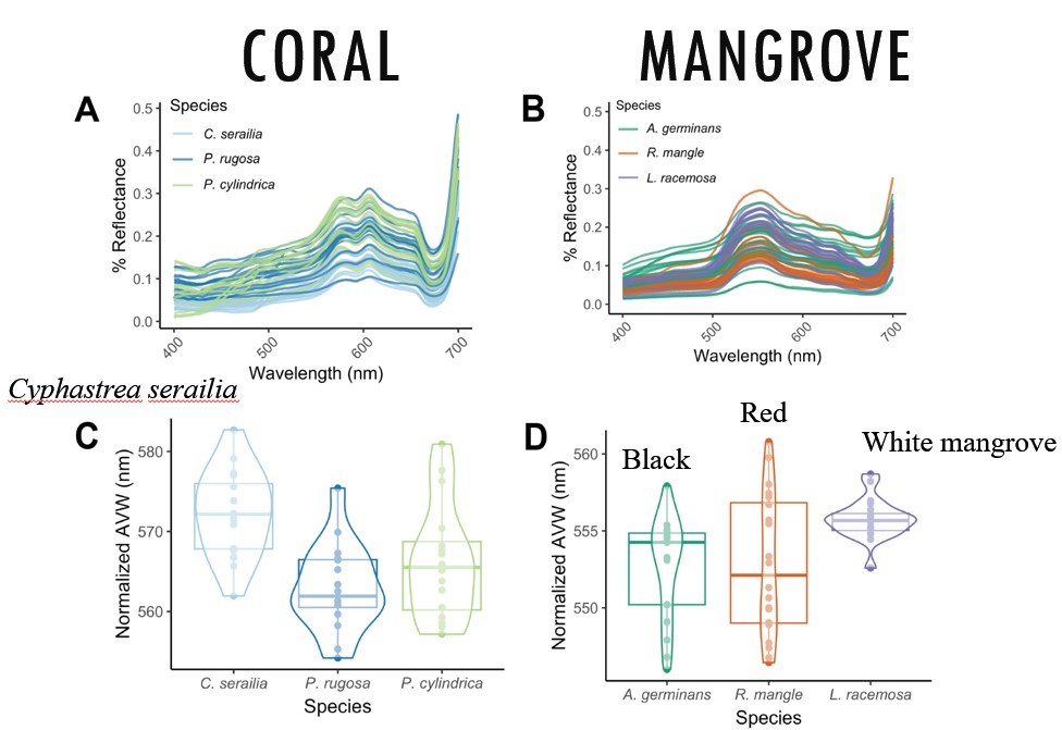
Quantifying and visualizing spectral variation is an important step in ecological remote sensing studies. The PACE mission will have two simple metrics for evaluating spectral shape and quality of reflectance spectra. The Apparent Visible Wavelength (AVW) is a one-dimensional geophysical metric of color calculated as a weighted harmonic mean across visible wavelengths. The Quality Water Index Polynomial (QWIP), based on AVW, is a metric to evaluate the quality of a retrieved water-leaving spectra compared to a global field dataset spanning blue, green and brown water types. Specifically, the QWIP represents a polynomial relationship between the hyperspectral AVW (or approximated using sensor-specific extrapolations) and a Normalized Difference Index (NDI) of red and green wavelengths.
We conducted a case study using imagery collected with the airborne Portable Remote Imaging Spectrometer (PRISM) over a mangrove forest in Florida showing ranges in AVW related to differences in clustering of vegetation. The AVW was used to evaluate trends in benthic ecosystems from seagrass to macroalgae using hyperspectral imagery collected from the Italian Space Agency PRISMA sensor in Long Island Sound. Additionally, we demonstrate how AVW and QWIP have applications to ecosystem-based fisheries management through radiometric processing using the HyperCP from ship-based measurements. The AVW and QWIP metrics provide simple tools to help evaluate spectral shape and magnitude for a variety of aquatic applications. Indeed, most researchers are well-equipped to “qwip” their data into shape.

Collaborators: Ryan Vandermuelen (NOAA)
Funding: NASA Ocean Biology and Biogeochemistry
Publications can be found here: Dierssen et al. (2022)
NASA Algorithm Theoretical Basis Documents with code and conversions to multi-sensor data: QWIP; AVW